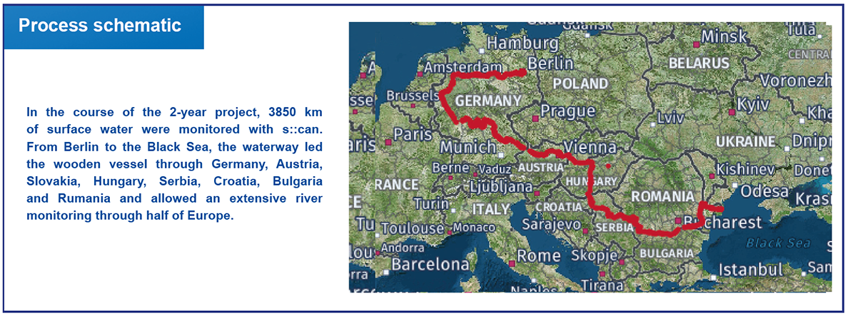
Researcher Carsten Riechelmann traveled on his selfmade catamaran through Europe, which he equipped with an s::can system to georeference the measured data. Longitudinal continuous profiles of all parameters were registered and displayed in real-time on online maps.
Danube River Monitoring from Berlin to the Black Sea – 3850 km of surface water monitored with s::can products

Background
Background
The German water engineer Carsten Riechelmann built the wooden catamaran, Esperanto, with the help of 90 volunteers from 20 different nations. The vessel is meant to be used as an environmental monitoring station and occasionally as an event stage. After working with s::can equipment in waste water research, Riechelmann realized that the high measurement frequency of the spectro::lyser can be used for a new form of dynamic surface water monitoring.
Challenge
Independent boats moving on water bodies could be used for collecting data of anthropogenic impacts. If a reliable data acquisition and calibration system is developed and the data is openly accessible, then water pollution is getting transparent for the public. This public awareness can help to increase the political leverage on individuals or companies that are profiting from pollution discharge.
s::can`s solution
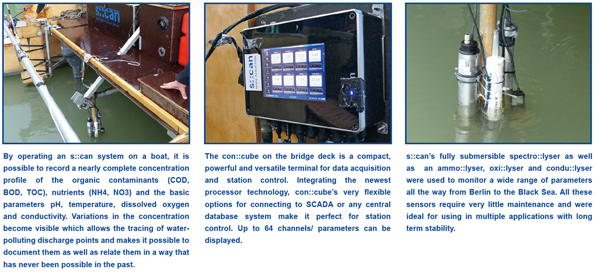
The boat was equipped with the terminal con::cube, spectro::lyser, ammo::lyser, oxi::lyser and condu::lyser. An instrument carrier holds the four sensors in the (up to 15 km/h fast) water stream. To adapt to the 1 kWp solar system, a low voltage con::cube was installed together with the automatic cleaning system ruck::sack for the spectro::lyser. Via the Wi-Fi module and the Modbus protocol, the con::cube was connected to a Raspberry PI. GPS coordinates were uploaded every two minutes together with measured parameters to a database. The tool Grafana visualized immediately each parameter on a map. Laboratory samples in the first year and the data of the Joint Danube Survey 4 in the second year were used to validate and to calibrate the online data.
Benefits
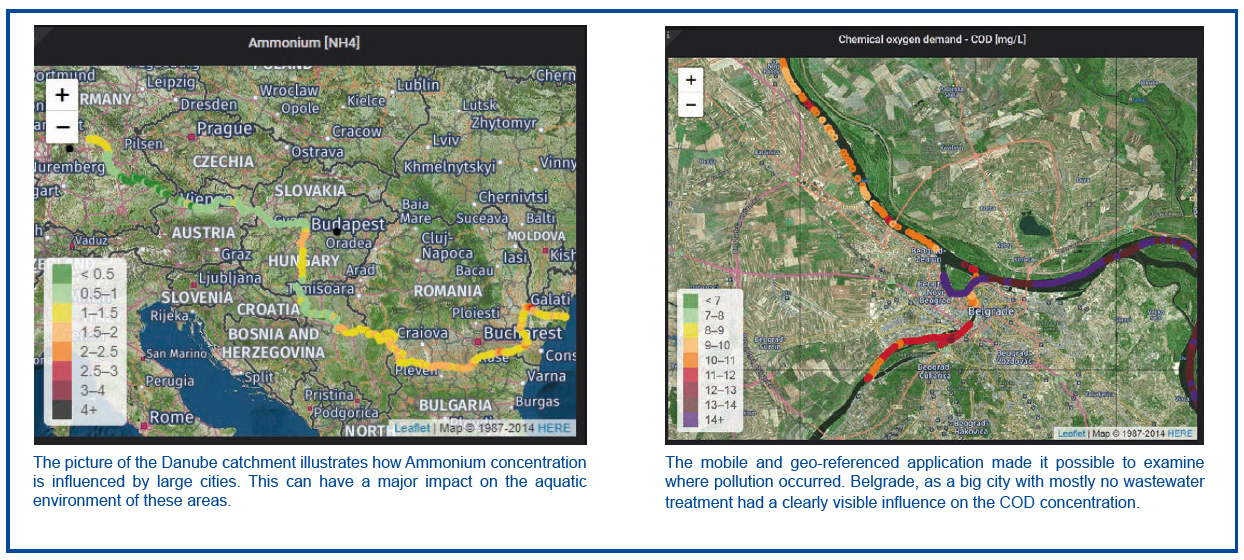
The s::can equipment was very stable and performed reliably. The low energy demand of the s::can system was ideal for the usage on board with limited energy supply. A full dataset was delivered every 200 m according to the average speed of the boat. The data could be checked directly on the con::cube or on any mobile phone. The mobile and geo-referenced application made it possible to examine spots where pollution sources were expected. This can help decision makers get a real-time overview to locate pollution sources and take counter-actions.